82 posts tagged “geospatial”
2022
geoBoundaries. This looks useful: “The world’s largest open, free and research-ready database of political administrative boundaries.” Founded by the geoLab at William & Mary university, and released under a Creative Commons Attribution license that includes a requirement for a citation. File formats offered include shapefiles, GeoJSON and TopoJSON.
lon lat lon lat lon. Tom MacWright’s definitive guide to the (latitude, longitude) v.s. (longitude, latitude) debate. The answer is frustrating: both orders are used by significant software, so there’s no single answer that will satisfy everyone. I’ve recently been mostly convinced over to the longitude, latitude side mainly because that’s a better fit for the non-geospatial x, y pattern.
2021
Weeknotes: datasette-tiddlywiki, filters_from_request
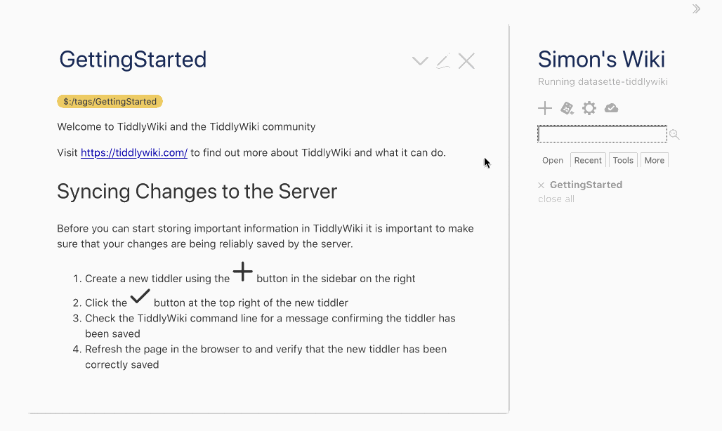
I made some good progress on the big refactor this week, including extracting some core logic out into a new Datasette plugin hook. I also got distracted by TiddlyWiki and released a new Datasette plugin that lets you run TiddlyWiki inside Datasette.
[... 1,197 words]Adding GeoDjango to an existing Django project
Work on VIAL for Vaccinate The States continues.
[... 1,503 words]country-coder (via) Given a latitude and longitude, how can you tell what country that point sits within? One way is to do a point-in-polygon lookup against a set of country polygons, but this can be tricky: some countries such as New Zealand have extremely complex outlines, even though for this use-case you don’t need the exact shape of the coastline. country-coder solves this with a custom designed 595KB GeoJSON file with detailed land borders but loosely defined ocean borders. It also comes with a wrapper JavaScript library that provides an API for resolving points, plus useful properties on each country with details like telepohen calling codes and emoji flags.
Spatialite Speed Test. Part of an excellent series of posts about SpatiaLite from 2012—here John C. Zastrow reports on running polygon intersection queries against a 1.9GB database file in 40 seconds without an index and 0.186 seconds using the SpatialIndex virtual table mechanism.
New call queue ready to test. Also geography.
I just shipped the first working preview version of the new /api/requestCall API [#54]—the API that our caller app uses to get the next location that the caller should be contacting (and lock it so that other users don’t call it at the same time).
Weeknotes: Finally, an intro video for Datasette
My big project this week was this Video introduction to Datasette and sqlite-utils. I recorded the video a few weeks ago in advance of FOSDEM, but this week I put together the annotated version. I’m really happy with it, and I’ve added it to the datasette.io homepage as a starting point for helping people understand the project.
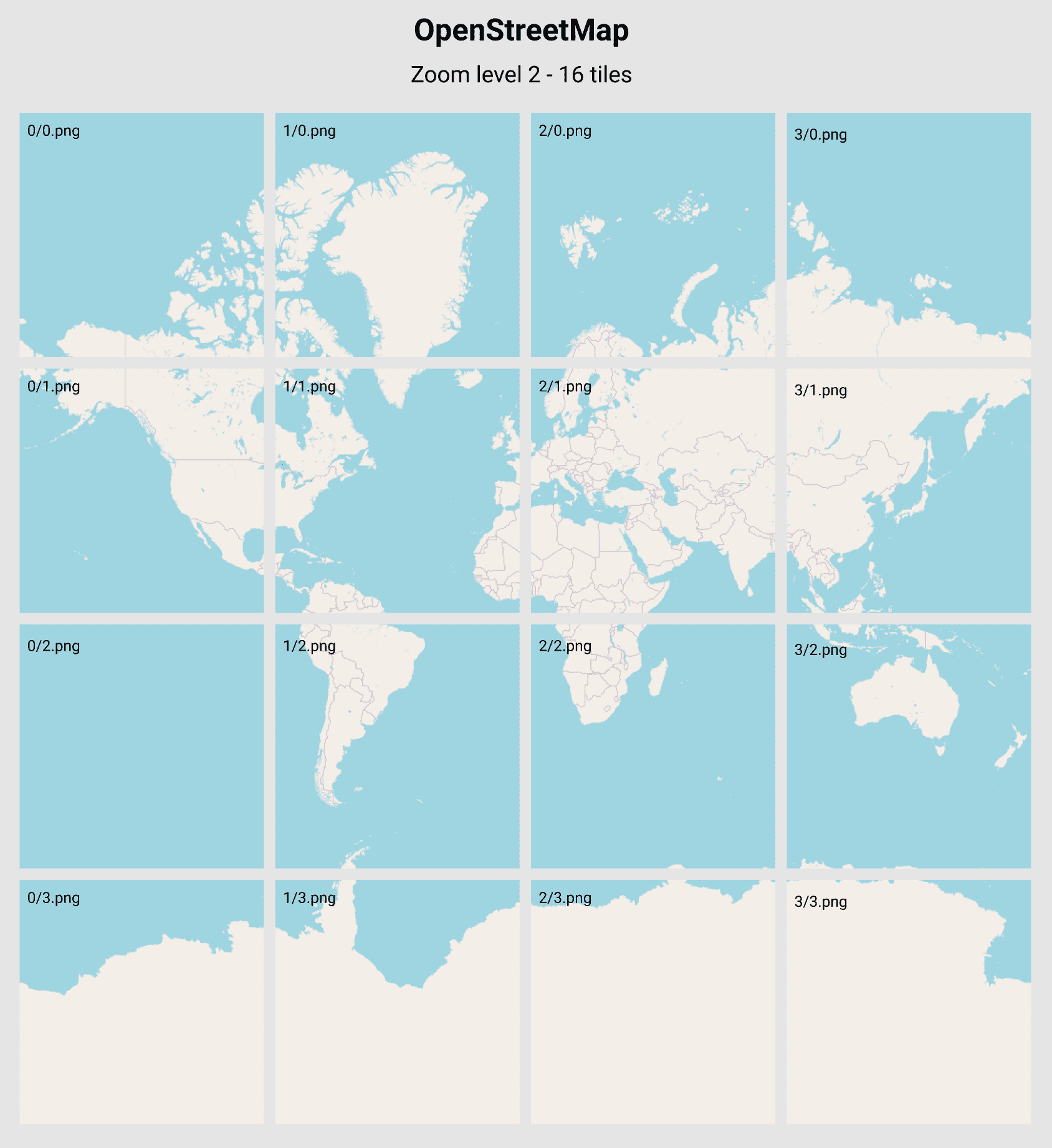
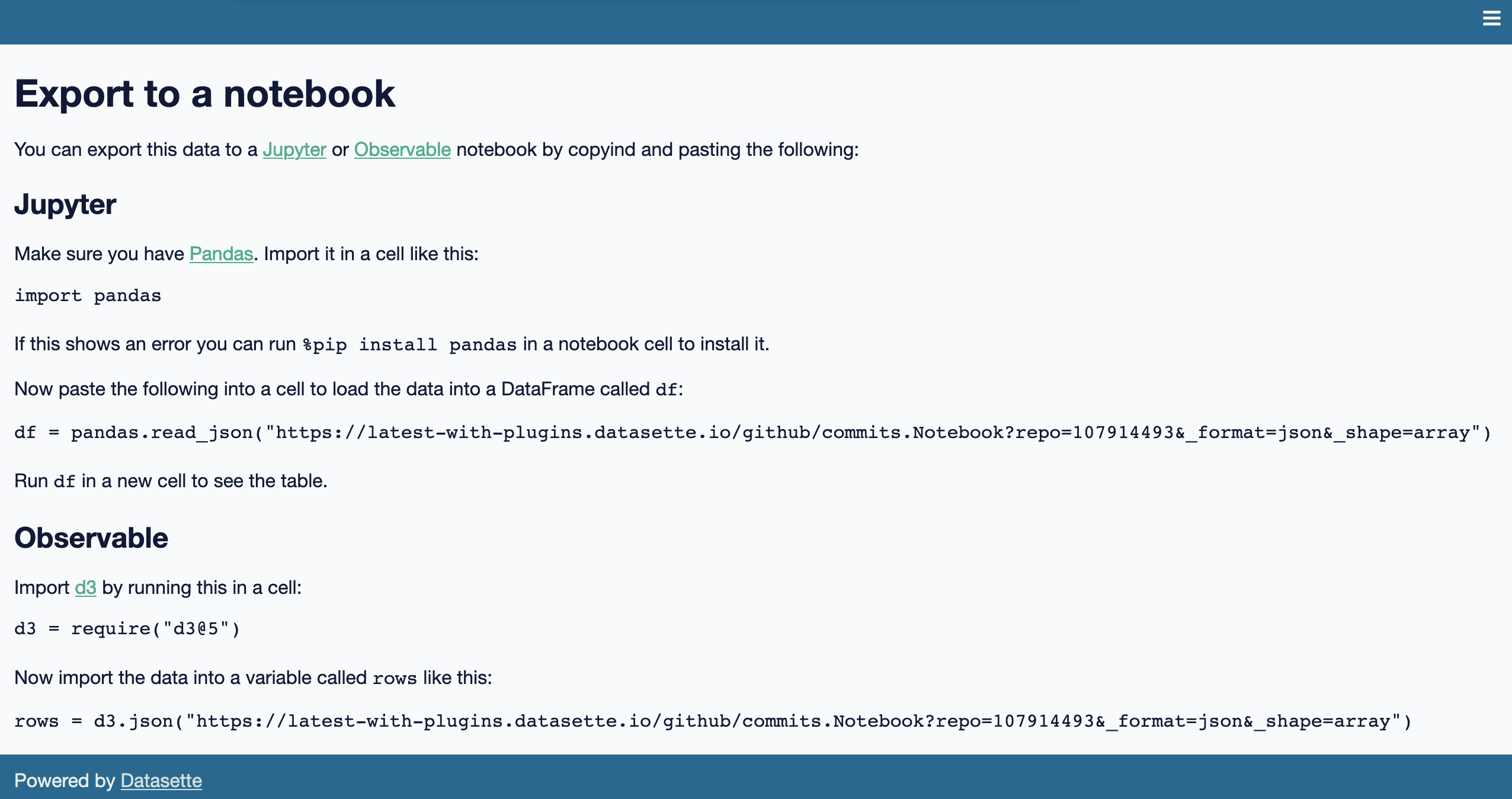
[... 690 words]Serving map tiles from SQLite with MBTiles and datasette-tiles
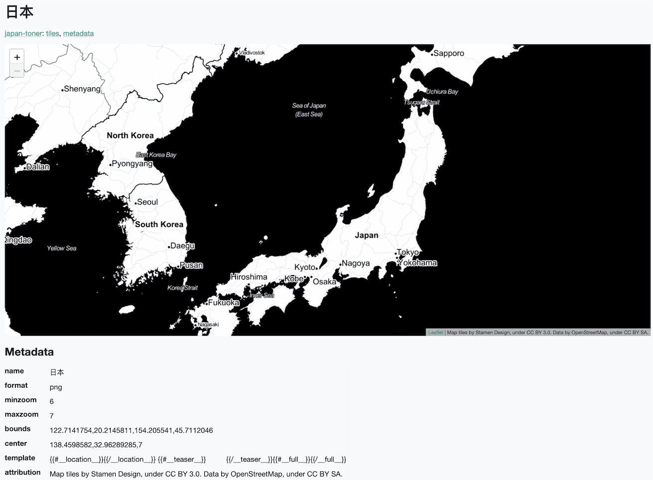
Working on datasette-leaflet last week re-kindled my interest in using Datasette as a GIS (Geographic Information System) platform. SQLite already has strong GIS functionality in the form of SpatiaLite and datasette-cluster-map is currently the most downloaded plugin. Most importantly, maps are fun!
[... 1,334 words]Drawing shapes on a map to query a SpatiaLite database (and other weeknotes)
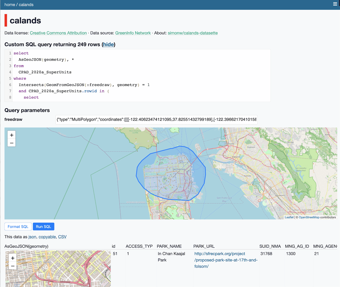
This week I built a Datasette plugin that lets you query a database by drawing shapes on a map!
[... 950 words]Weeknotes: datasette-export-notebook, PyInstaller packaged Datasette, CBSAs
What a terrible week. I’ve found it hard to concentrate on anything substantial. In a mostly futile attempt to distract myself from doomscrolling I’ve mainly been building some experimental output plugins, fiddling with PyInstaller and messing around with shapefiles.
[... 732 words]2020
Weeknotes: California Protected Areas in Datasette
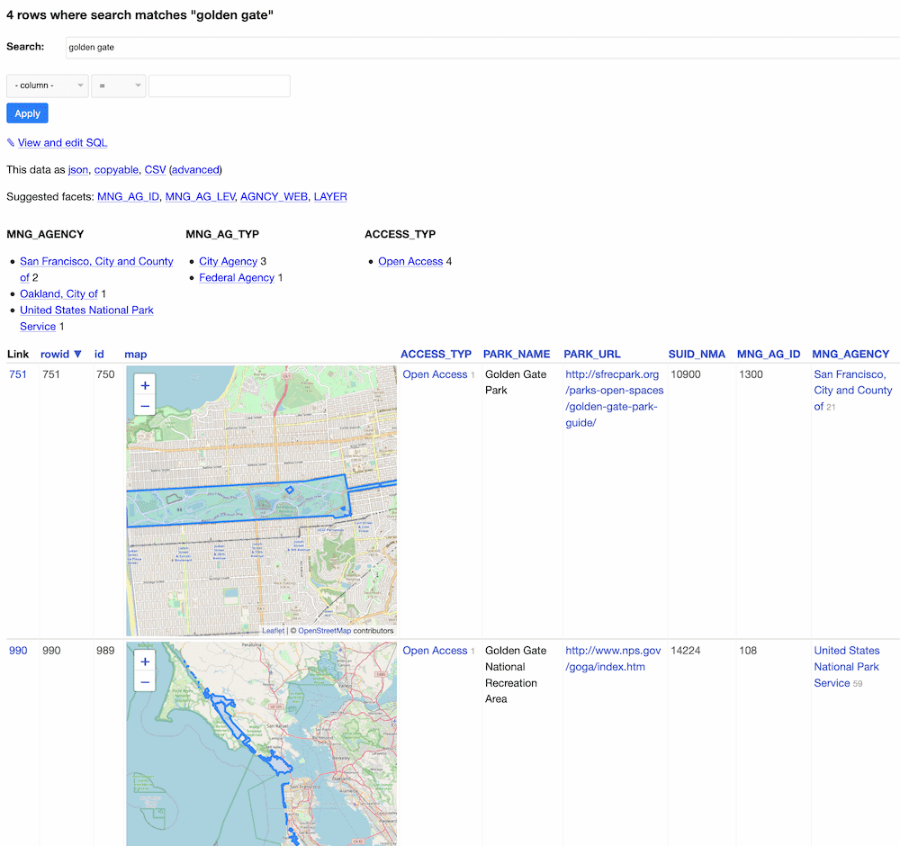
This week I built a geospatial search engine for protected areas in California, shipped datasette-graphql 1.0 and started working towards the next milestone for Datasette Cloud.
[... 1,099 words]California Protected Areas Database in Datasette (via) I built this yesterday: it’s a Datasette interface on top of the CPAD 2020 GIS database of protected areas in California maintained by GreenInfo Network. This was a useful excuse to build a GitHub Actions flow that builds a SpatiaLite database using my shapefile-to-sqlite tool, and I fixed a few bugs in my datasette-leaflet-geojson plugin as well.
Things I learned about shapefiles building shapefile-to-sqlite
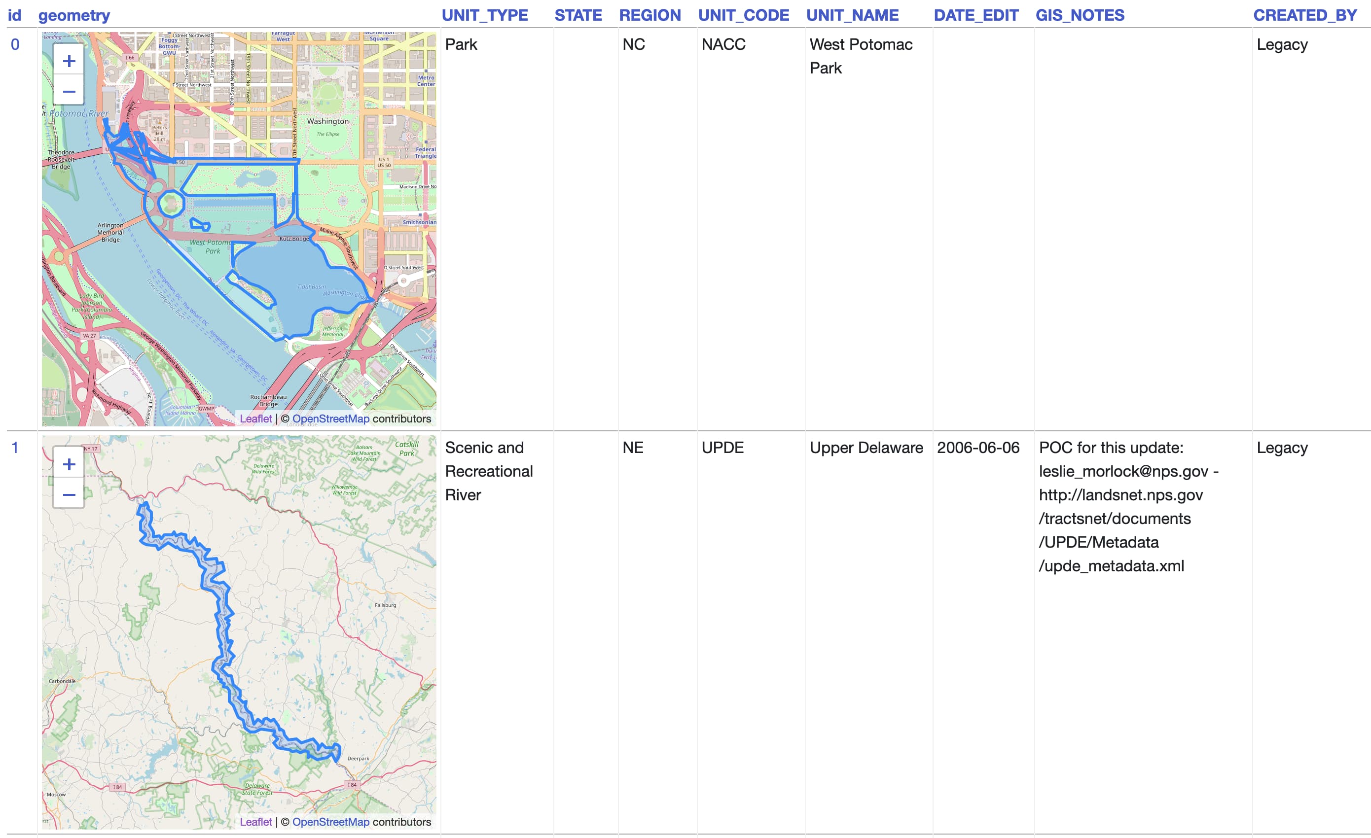
The latest in my series of x-to-sqlite tools is shapefile-to-sqlite. I learned a whole bunch of things about the ESRI shapefile format while building it.
[... 1,073 words]geojson-to-sqlite (via) I just put out the first release of geojson-to-sqlite—a CLI tool that can convert GeoJSON files (consisting of a Feature or a set of features in a FeatureCollection) into a table in a SQLite database. If you use the --spatialite option it will initalize the table with SpatiaLite and store the geometries in a spacially indexed geometry field—without that option it stores them as GeoJSON.
2019
kepler.gl. Uber built this open source geospatial analysis tool for large-scale data sets, and they offer it as a free hosted online tool—just click Get Started on the site. I uploaded two CSV files with 30,000+ latitude/longitude points in them just now and used Kepler to render them as images.
Thematic map—GIS Wiki. This is a really useful wiki full of GIS information, and the coverage of different types of thematic maps is particularly thorough.
Los Angeles Weedmaps analysis (via) Ben Welsh at the LA Times published this Jupyter notebook showing the full working behind a story they published about LA’s black market weed dispensaries. I picked up several useful tricks from it—including how to load points into a geopandas GeoDataFrame (in epsg:4326 aka WGS 84) and how to then join that against the LA Times neighborhoods GeoJSON boundaries file.
D3 Projection Comparison (via) Fun Observable notebook that lets you compare any two out of D3’s 96 (!) geographical projections of the world.
togeojson (via) Handy JavaScript library and command-mine tool for converting KML and GPX to GeoJSON, by Tom MacWright
2018
VirtualKNN for SpatiaLite. This looks amazing: a special virtual table shipped as part of SpatiaLite 4.4.0 which implements a fast, R-Tree backed mechanism for finding the X nearest points against a geospatial database table. There’s just one catch: it’s only available in 4.4.0, but the most recent “stable” release of SpatiaLite is 4.3.0a from September 2015 so the version you get if you install from apt-get or homebrew doesn’t yet have this functionality. I’d love to figure out a neat way to package and distribute this along with Datasette. I’d also like to figure out a clean way to ship a more recent version of SQLite than the one that is currently packaged with Python 3 (3.16.2, where the latest SQLite release is 3.23.1).
Nicaraguan Address System (via) “Instead of street names or numbers Nicaraguans use reference points from where they start describing a certain address. [...] There are instances, however, in which the reference points do not exist anymore!”
Generating polygon representing a rough 100km circle around latitude/longitude point using Python. A question I posted to the GIS Stack Exchange—I found my own answer using a Python library called geog, then someone else posted a better solution using pyproj.
2017
Building a location to time zone API with SpatiaLite, OpenStreetMap and Datasette
Given a latitude and longitude, how can we tell what time zone that point lies within? Here’s how I built a simple JSON API to answer that question, using a combination of data from OpenStreetMap, the SpatiaLite extension for SQLite and my Datasette API tool.
[... 2,185 words]simonepri/geo-maps. Neat project which publishes GeoJSON maps of the world automatically derived from OpenStreetMap. Three variants are available: country political maritime boundaries, country political coastline boundaries and a general outline of the world’s land territories.
Interactive Database of the World’s River Basins (via) “This database provides the first-ever compilation of the world’s river basins developed specifically for corporate disclosure. It features a comprehensive list of river basins worldwide, including their names, boundaries, and other helpful information.”
Fast GeoSpatial Analysis in Python. Some clever advanced performance tricks with Cython and Dask, but it also introduced me to GeoPandas.
Feature request: a batch version of mapzen.places.getHierarchiesByLatLon. I’ve been having a lot of fun filing issues against various Mapzen / Who’s On First repositories recently—mainly because the team there are incredibly responsive to suggestions and feature requests. Here’s a fun thread where Aaron Straup Cope and myself have been bouncing around some ideas around batch API design.
2010
[UPDATE] Spatial Search in Apache Lucene and Solr. Spacial search is finally coming (back) to Solr—trunk now supports sorting and boosting by distance.
Of Building Blocks, Rosetta Stones and Geographic Identifiers. Yahoo! GeoPlanet is now mapped to identifiers from other gazetteers such as GeoNames, FIPS and IATA—and those identifiers are available via the GeoPlanet API.